제7장 [보충자료] ggmap, ggplot2 패키지를 이용한 지도 출력 및 경로 표현하기 간단예제
xxxxxxxxxx# R에서 ggmap, ggplot2 패키지를 이용한 지도 출력 및 경로 표현하기 간단예제# https://lovetoken.github.io/r/data_visualization/2016/10/18/ggmap.html#++++++++++++++++++++++++++++++++++++++++++++++++++++++++++++++++++++++++++++install.packages("ggmap")install.packages("ggplot2")library(ggmap)library(ggplot2)register_google(key="Google API Key")# 대한민국geocode('Korea', source='google')결과 :
xxxxxxxxxx## Source : https://maps.googleapis.com/maps/api/geocode/json?address=Korea&key=xxx## # A tibble: 1 x 2## lon lat## <dbl> <dbl>## 1 128. 37.7
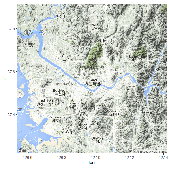
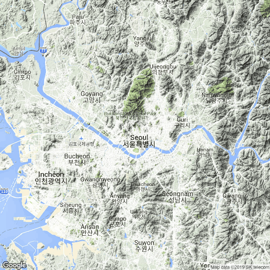
xxxxxxxxxx# 서울 getmap <- get_googlemap("seoul")(p1 <- ggmap(getmap)) # 그림 1.결과 :
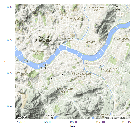
xxxxxxxxxx# p1 <- get_googlemap("seoul") %>% ggmaplocationInfo <- data.frame( Name = c("서초역", "강남역"), lon = c(127.007675, 127.027544), lat = c(37.491843, 37.497968) )p1 + geom_point(data = locationInfo, aes(x = lon, y = lat)) # 그림 2.결과 :

xxxxxxxxxx# 지도 확대하기getmap <- get_googlemap("gangnamgu", zoom = 12)p2 <- ggmap(getmap)p2 + geom_point(data = locationInfo, aes(x = lon, y = lat)) # 그림 3.결과 :
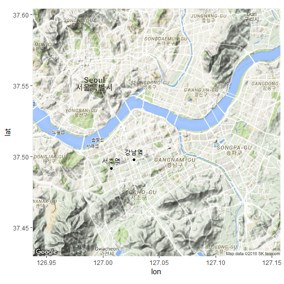
xxxxxxxxxx# 두 점에 지역명 표시하기p2 + geom_point(data = locationInfo, aes(x = lon, y = lat)) + geom_text(data = locationInfo, aes(label = Name), size = 3, vjust = -1) # 그림 4.결과 :
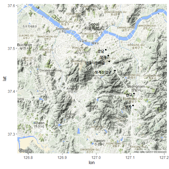
xxxxxxxxxx# 신분당선 전철 경로 그리기locationInfo <- data.frame( Name = c("강남", "양재", "양재시민의숲", "청계산입구", "판교", "정자"), lon = c(127.028046, 127.035140, 127.038451, 127.054769, 127.111172, 127.108367), lat = c(37.497001, 37.483368, 37.469655, 37.448196, 37.394786, 37.366777))locationInfogetmap <- get_googlemap("gwacheon", zoom = 11)p3 <- ggmap(getmap)p3 <- p3 + geom_point(data = locationInfo, aes(x = lon, y = lat)) + geom_text(data = locationInfo, aes(label = Name), size = 4, hjust = 1.2, fontface = "bold")p3결과 :
xxxxxxxxxxp3 + geom_path(data = locationInfo, aes(x = lon, y = lat), color = "blue", alpha = .5, lwd = 1) # 그림 5. 신 분당선 경로 표시결과 :

xxxxxxxxxx## extent=device# option의 설정# 1) extent = "device" getmap <- get_googlemap("seoul")(p4 <- ggmap(getmap, extent = "device")) # 그림 6.결과 :
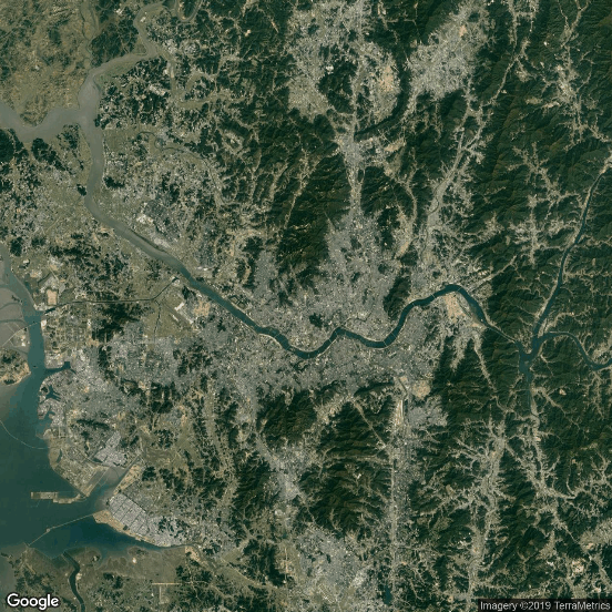
xxxxxxxxxx# 2) get_googlemap(maptype = "satellite") : 4 종류 : "terrain", "satellite", "roadmap", "hybrid"getmap <- get_googlemap("seoul", maptype = "satellite")(p5 <- ggmap(getmap, extent = "device")) # 그림 7.결과 :
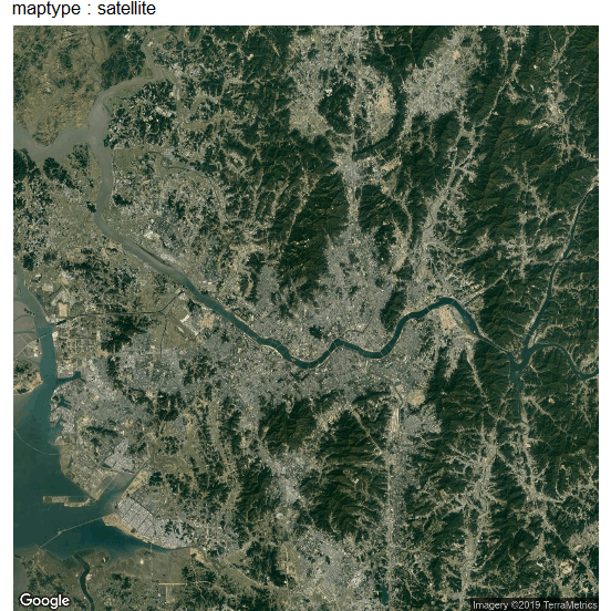
xxxxxxxxxx# 3) 제목 달기p5 + ggtitle("maptype : satellite") # 그림 8.결과 :


![]()
![]()
![]()